alb3548831
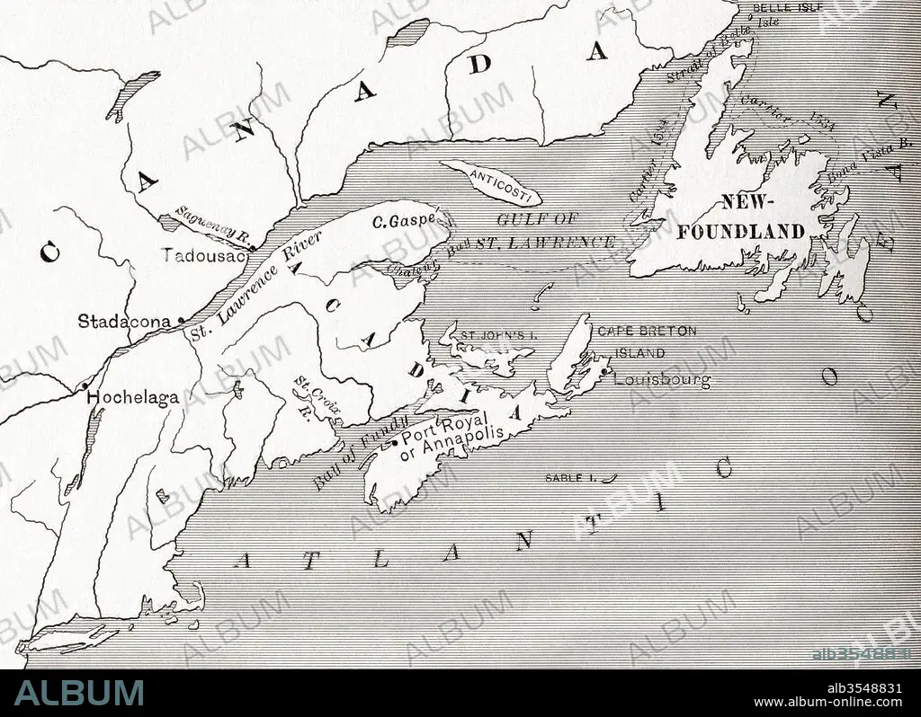
Map of Acadia, 17th century colony of New France in northeastern North America, and the water highway to Canada
| Partager |
|---|
 Pinterest Pinterest |
 Twitter Twitter |
 Facebook Facebook |
 Copier le lien Copier le lien |
 Email Email |
|
Ajouter à une autre Lightbox |
|
Ajouter à une autre Lightbox |


Avez-vous déjà un compte? S'identifier
Vous n'avez pas de compte ? S'inscrire
Acheter cette image.
Sélectionnez l'usage:

Titre:
Map of Acadia, 17th century colony of New France in northeastern North America, and the water highway to Canada
Légende:
Voir la traduction automatique
Map of Acadia, 17th century colony of New France in northeastern North America, and the water highway to Canada. From The History of Our Country, published 1899
Crédit:
Album / Universal Images Group / Universal History Archive
Autorisations:
Taille de l'image:
5075 x 3690 px | 53.6 MB
Taille d'impression:
43.0 x 31.2 cm | 16.9 x 12.3 in (300 dpi)
Mots clés:
17E SIECLE • 17EME S • AMÉRCAIN • AMERICAIN (ETATS-UNIS) • AMERICAIN (USA) • AMÉRICAIN • AMÉRICAINE • AMÉRICIAN • AMÉRICIANE • AMERIQUE • AMERIQUE, CONTINENT • AUTOROUTE • CANADA • CARTE (GEOGRAPHIE) • CARTE GEOGRAPHIQUE • CARTE • COLONIE • CONTINENT AMERIQUE • DESSIN PLANS • DIX-SEPTIÈME SIÈCLE • EAU • ÉTAS UNIS • ÉTAS-UNIS • ETATS UNIS • ETATS-UNIS • FRANÁAIS • FRANÁAISE • FRANÇAIS • GEOGRAPHIE • HIGHWAY • NORD • PAYS • PLAN (CARTOGRAPHIE) • PLANS • QUATRE ELEMENTS: EAU • U. S. A. • XVIIE SIECLE • ŽTATS-UNIS
