alb5092835
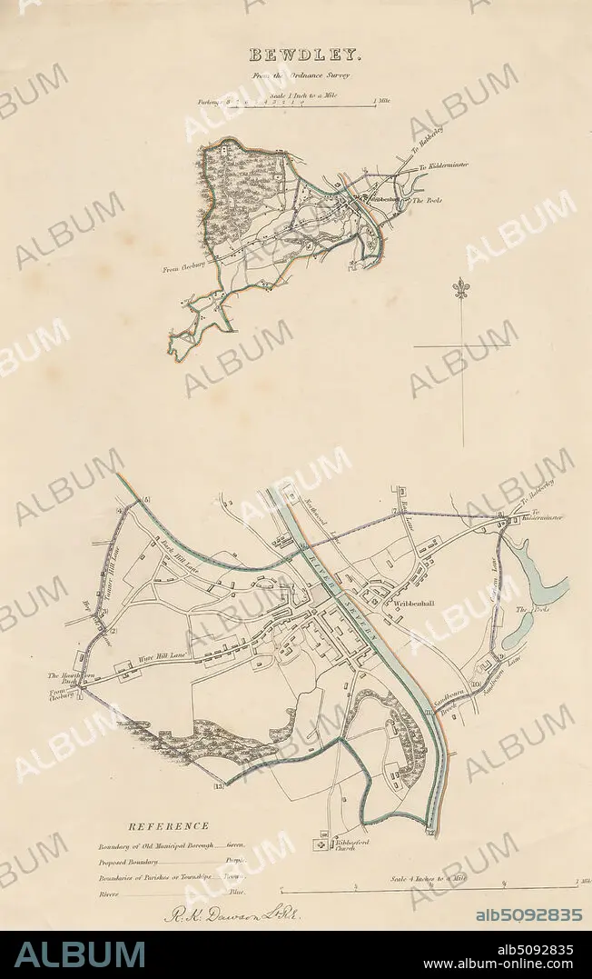
Map of Bewdley from the Ordnance Survey, Print made by Robert Kearsley Dawson, 17981861, British, undated, Etching with hand coloring on moderately thick, slightly textured, cream wove paper, Sheet: 13 9/16 x 8 7/16 inches (34.4 x 21.4 cm) and Image: 10 3/4 x 7 inches (27.3 x 17.8 cm), architectural subject, boundaries, cartographic material, cartography, key (text), map, river, scale (rule), still life, streets, town, Bewdley, England, Hereford and Worcester, Severn, United Kingdom.
| Partager |
|---|
 Pinterest Pinterest |
 Twitter Twitter |
 Facebook Facebook |
 Copier le lien Copier le lien |
 Email Email |
|
Ajouter à une autre Lightbox |
|
Ajouter à une autre Lightbox |


Avez-vous déjà un compte? S'identifier
Vous n'avez pas de compte ? S'inscrire
Acheter cette image.
Sélectionnez l'usage:

Légende:
Voir la traduction automatique
Map of Bewdley from the Ordnance Survey, Print made by Robert Kearsley Dawson, 17981861, British, undated, Etching with hand coloring on moderately thick, slightly textured, cream wove paper, Sheet: 13 9/16 x 8 7/16 inches (34.4 x 21.4 cm) and Image: 10 3/4 x 7 inches (27.3 x 17.8 cm), architectural subject, boundaries, cartographic material, cartography, key (text), map, river, scale (rule), still life, streets, town, Bewdley, England, Hereford and Worcester, Severn, United Kingdom
Crédit:
Album / quintlox
Autorisations:
Taille de l'image:
3177 x 4992 px | 45.4 MB
Taille d'impression:
26.9 x 42.3 cm | 10.6 x 16.6 in (300 dpi)
Mots clés:
ANGLETARRE • ANGLETERE • ANGLETERRE • CARTE (GEOGRAPHIE) • CARTE GEOGRAPHIQUE • CARTE • CARTOGRAPHIE • CITE • CLÉ • CLEF • DESSIN PLANS • EMPREINTE • FLUVIALE • GRANDE BERTAGNE • GRANDE BRETAGNE • GRANDE-BRETAGNE • INGLATERRA • PLAN (CARTOGRAPHIE) • PLANS • ROYAUME UNI • ROYAUME-UNI • SCIENCE: CARTOGRAPHIE • TEXTE • VIE • VILE • VILLE
