alb4090241
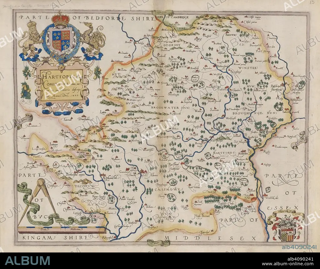
CHRISTOPHER SAXTON. Hertfordshire. Atlas of the Counties of England and Wales. London, 1579. Map of Hertfordshire. Image taken from Atlas of the Counties of England and Wales. Originally published/produced in 1579. Source: Maps.C.3.bb.5, 13.
| Partager |
|---|
 Pinterest Pinterest |
 Twitter Twitter |
 Facebook Facebook |
 Copier le lien Copier le lien |
 Email Email |
|
Ajouter à une autre Lightbox |
|
Ajouter à une autre Lightbox |


Avez-vous déjà un compte? S'identifier
Vous n'avez pas de compte ? S'inscrire
Acheter cette image

Légende:
Voir la traduction automatique
Hertfordshire. Atlas of the Counties of England and Wales. London, 1579. Map of Hertfordshire. Image taken from Atlas of the Counties of England and Wales. Originally published/produced in 1579. Source: Maps.C.3.bb.5, 13.
Crédit:
Album / British Library
Autorisations:
Modèle: Non - Propriété: Non
Questions sur les droits?
Questions sur les droits?
Taille de l'image:
10000 x 7913 px | 226.4 MB
Taille d'impression:
84.7 x 67.0 cm | 33.3 x 26.4 in (300 dpi)
Mots clés:
