alb3924201
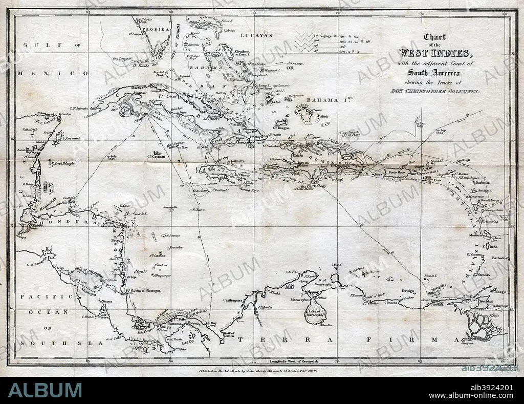
Chart of the West Indies, with the adjacent Coast of South America, 1830. Artist: J&C Walker
| Partager |
|---|
 Pinterest Pinterest |
 Twitter Twitter |
 Facebook Facebook |
 Copier le lien Copier le lien |
 Email Email |
|
Ajouter à une autre Lightbox |
|
Ajouter à une autre Lightbox |


Avez-vous déjà un compte? S'identifier
Vous n'avez pas de compte ? S'inscrire
Acheter cette image.
Sélectionnez l'usage:

Titre:
Chart of the West Indies, with the adjacent Coast of South America, 1830. Artist: J&C Walker
Légende:
Voir la traduction automatique
Chart of the West Indies, with the adjacent Coast of South America, 1830. Map of the Caribbean, showing the tracks of Christopher Columbus.
Crédit:
Album / The Print Collector / Heritage Images
Autorisations:
Taille de l'image:
4940 x 3549 px | 50.2 MB
Taille d'impression:
41.8 x 30.0 cm | 16.5 x 11.8 in (300 dpi)
Mots clés:
15 15E 15EME XV XVE XVEME SIECLE • 15E SIECLE • 15EME S • 16E SIECLE • 16EME S • AMERIQUE LATINE (AMERIQUE DU SUD) • AMERIQUE LATINE • CARAIBE • CARAIBES • CARTE • CARTOGRAPHIE • CHERCHEUR • DÉCOUVERTE • DECOUVREUR • ESPAGNE • EXPLORATEUR • EXPLORATION • GEOGRAPHIE • ITALIE • MONOCHROME • NOIR ET BLANC • QUINZIÈME SIÈCLE • SCIENCE: CARTOGRAPHIE • SEIZIÈME SIÈCLE • TRANSPORT VOYAGE • TRAVERSÉE • VOYAGE • XVE SIECLE • XVIE SIECLE
