alb3182088
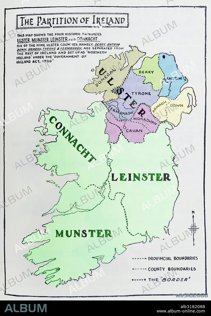
Map of the partition of Ireland
| Partager |
|---|
 Pinterest Pinterest |
 Twitter Twitter |
 Facebook Facebook |
 Copier le lien Copier le lien |
 Email Email |
|
Ajouter à une autre Lightbox |
|
Ajouter à une autre Lightbox |


Avez-vous déjà un compte? S'identifier
Vous n'avez pas de compte ? S'inscrire
Acheter cette image

Titre:
Map of the partition of Ireland
Légende:
Voir la traduction automatique
Map of the partition of Ireland; the division of the island of Ireland into two distinct territories; Northern Ireland and Southern Ireland in 1921
Crédit:
Album / Universal Images Group / Universal History Archive
Autorisations:
Modèle: Non - Propriété: Non
Questions sur les droits?
Questions sur les droits?
Taille de l'image:
3843 x 5457 px | 60.0 MB
Taille d'impression:
32.5 x 46.2 cm | 12.8 x 18.2 in (300 dpi)
Mots clés:
CARTE (GEOGRAPHIE) • CARTE GEOGRAPHIQUE • CARTE • DESSIN PLANS • ILE • ÎLES • IRELANDE • IRLANDE • PLAN (CARTOGRAPHIE) • PLANS
