alb9221020
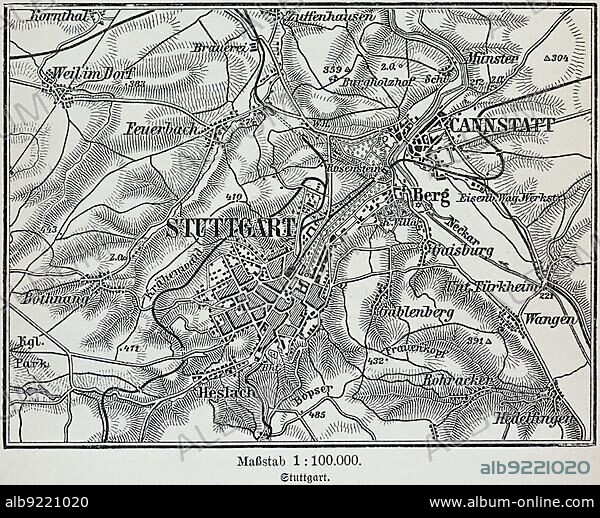
City map of Stuttgart, Baden-Württemberg, scale 1:10.000, state capital, districts, Zuffenhausen, Cannstatt, Untertürkheim, Bopser, map, cartography, railway lines, dead-end station, surrounding area, historical illustration 19th century.
| Partager |
|---|
 Pinterest Pinterest |
 Twitter Twitter |
 Facebook Facebook |
 Copier le lien Copier le lien |
 Email Email |
|
Ajouter à une autre Lightbox |
|
Ajouter à une autre Lightbox |


Avez-vous déjà un compte? S'identifier
Vous n'avez pas de compte ? S'inscrire
Acheter cette image.
Sélectionnez l'usage:

Légende:
Voir la traduction automatique
City map of Stuttgart, Baden-Württemberg, scale 1:10.000, state capital, districts, Zuffenhausen, Cannstatt, Untertürkheim, Bopser, map, cartography, railway lines, dead-end station, surrounding area, historical illustration 19th century
Crédit:
Album / ImageBroker / Wolfgang Diederich
Autorisations:
Modèle: Non - Propriété: Non
Questions sur les droits?
Questions sur les droits?
Taille de l'image:
4660 x 3765 px | 50.2 MB
Taille d'impression:
39.5 x 31.9 cm | 15.5 x 12.6 in (300 dpi)
Mots clés:
