alb3832883
Landsat Image Mosaic of Antarctica
| Partager |
|---|
 Pinterest Pinterest |
 Twitter Twitter |
 Facebook Facebook |
 Copier le lien Copier le lien |
 Email Email |
|
Ajouter à une autre Lightbox |
|
Ajouter à une autre Lightbox |


Avez-vous déjà un compte? S'identifier
Vous n'avez pas de compte ? S'inscrire
Acheter cette image.
Sélectionnez l'usage:

Titre:
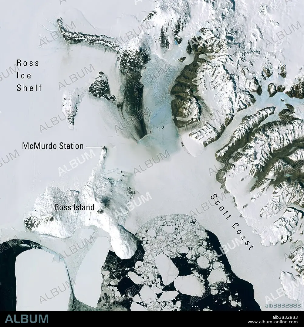
Landsat Image Mosaic of Antarctica
Légende:
Voir la traduction automatique
Satellite image acquired on December 27, 2001 by the Enhanced Thematic Mapper Plus (ETM+) sensor onboard Landsat 7, which displays a portion of the natural color mosaic over McMurdo Station, the largest research base in Antarctica. Ross Island is roughly 45 miles across at its widest point. This image is part of the Landsat Image Mosaic of Antarctica (LIMA). The project was developed by the U.S. Geological Survey, the British Antarctic Survey, and NASA, with funding from the National Science Foundation.
Crédit:
Album / Science Source / Landsat Image Mosaic of Antarctica Project
Autorisations:
Modèle: Non - Propriété: Non
Questions sur les droits?
Questions sur les droits?
Taille de l'image:
2325 x 2377 px | 15.8 MB
Taille d'impression:
19.7 x 20.1 cm | 7.7 x 7.9 in (300 dpi)
Mots clés:
