alb4205523
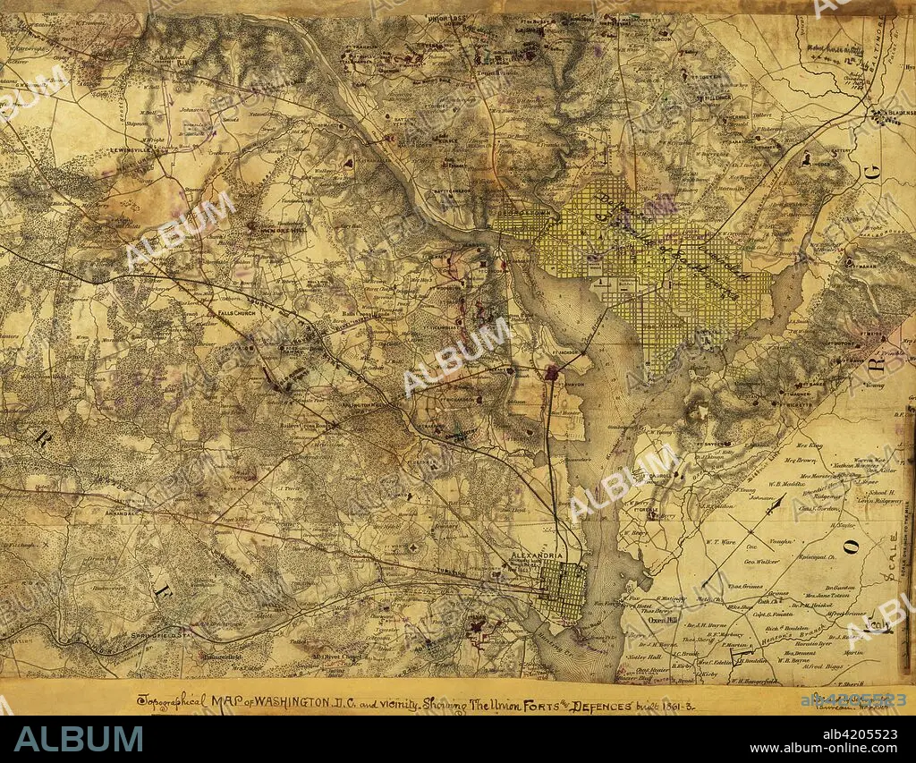
Washington, D. C., Showing the Union forts and defenses
| Partager |
|---|
 Pinterest Pinterest |
 Twitter Twitter |
 Facebook Facebook |
 Copier le lien Copier le lien |
 Email Email |
|
Ajouter à une autre Lightbox |
|
Ajouter à une autre Lightbox |


Avez-vous déjà un compte? S'identifier
Vous n'avez pas de compte ? S'inscrire
Acheter cette image.
Sélectionnez l'usage:

Titre:
Washington, D. C., Showing the Union forts and defenses
Légende:
Voir la traduction automatique
Topographical map of Washington, D.C., and vicinity. Showing the Union forts and defenses built 1861-3.. Topographical map of Washington, D.C., and vicinity. Showing the Union forts and defenses built 1861-3. Issued by Topographical Bureau, War Department, Col. Woodruff. - Col. Woodruff
Crédit:
Album / Universal Images Group / Universal History Archive/UIG
Autorisations:
Modèle: Non - Propriété: Non
Questions sur les droits?
Questions sur les droits?
Taille de l'image:
5242 x 4094 px | 61.4 MB
Taille d'impression:
44.4 x 34.7 cm | 17.5 x 13.6 in (300 dpi)
Mots clés:
