alb4094495
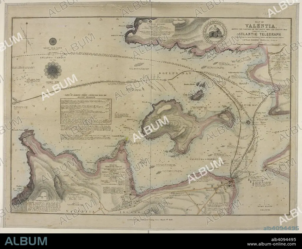
FREDERIC BRINE. Map showing a coast of Valentia island and the harbour; Doulus bay; and the lines of cables connected with the Atlantic telegraph. Map of Valentia shewing the positions of the various Ships and Lines of Cable connected with the Atlantic Telegraph. Compiled ... by Captain F. Brine. London : E. Stanford, 1859. Source: Maps.12094.(1).
| Partager |
|---|
 Pinterest Pinterest |
 Twitter Twitter |
 Facebook Facebook |
 Copier le lien Copier le lien |
 Email Email |
|
Ajouter à une autre Lightbox |
|
Ajouter à une autre Lightbox |


Avez-vous déjà un compte? S'identifier
Vous n'avez pas de compte ? S'inscrire
Acheter cette image.
Sélectionnez l'usage:

Auteur:
Légende:
Voir la traduction automatique
Map showing a coast of Valentia island and the harbour; Doulus bay; and the lines of cables connected with the Atlantic telegraph. Map of Valentia shewing the positions of the various Ships and Lines of Cable connected with the Atlantic Telegraph. Compiled ... by Captain F. Brine. London : E. Stanford, 1859. Source: Maps.12094.(1).
Crédit:
Album / British Library
Autorisations:
Modèle: Non - Propriété: Non
Questions sur les droits?
Questions sur les droits?
Taille de l'image:
5760 x 4456 px | 73.4 MB
Taille d'impression:
48.8 x 37.7 cm | 19.2 x 14.9 in (300 dpi)
Mots clés:
