alb5668872
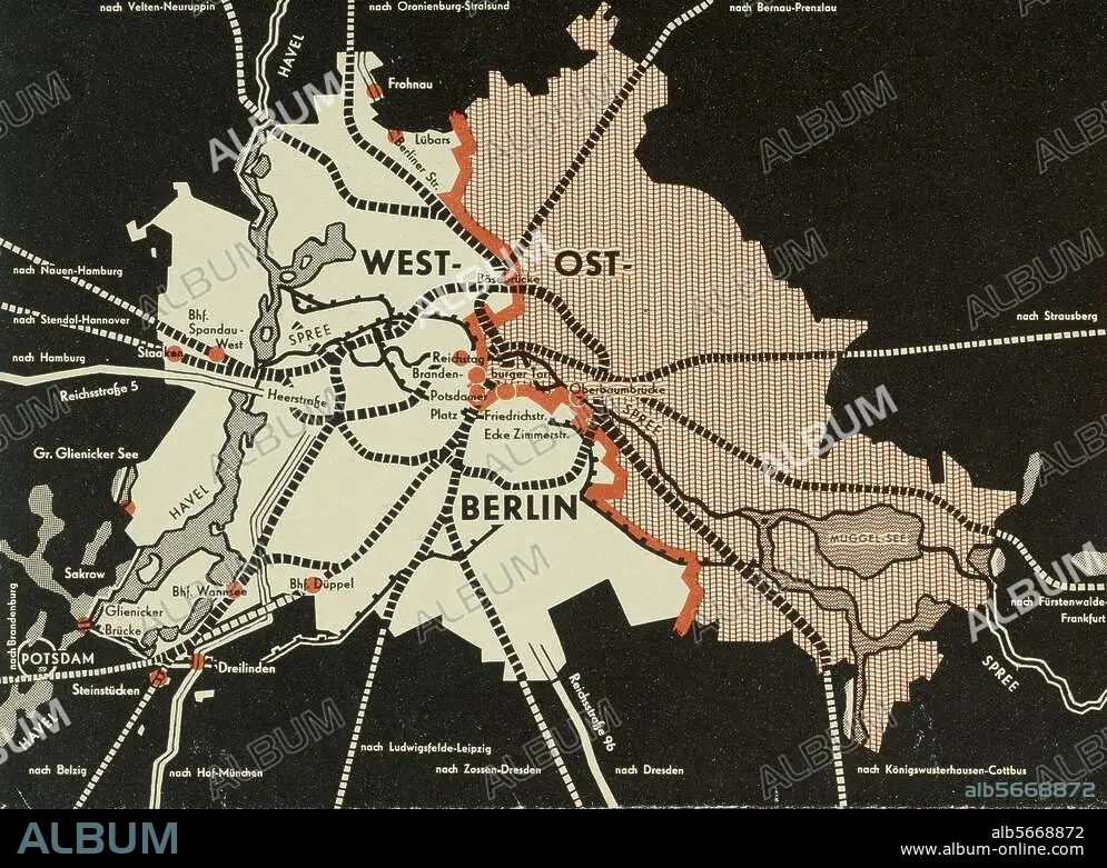
Free City Between Barbed Wire / Map of Berlin Showing Sector Boundaries / Pamphlet, 1959
| Partager |
|---|
 Pinterest Pinterest |
 Twitter Twitter |
 Facebook Facebook |
 Copier le lien Copier le lien |
 Email Email |
|
Ajouter à une autre Lightbox |
|
Ajouter à une autre Lightbox |


Avez-vous déjà un compte? S'identifier
Vous n'avez pas de compte ? S'inscrire
Acheter cette image.
Sélectionnez l'usage:

Titre: Free City Between Barbed Wire / Map of Berlin Showing Sector Boundaries / Pamphlet, 1959
Légende: Voir la traduction automatique
Berlin / Cold War. Map of East and West Berlin showing sector boundaries. The Eastern sector is empty (striped). Back of a West German government pamphlet on German issues with the title: "Free City between Barbed Wire", 1959.
Berlin / Cold War. Map of East and West Berlin showing sector boundaries. The Eastern sector is empty (striped). Back of a West German government pamphlet on German issues with the title: "Free City between Barbed Wire", 1959.
Technique/matériel: ESTAMPE
Emplacement: BERLIN
Crédit: Album / akg-images
Autorisations: ? Autorisation de modèle: Non - ? Autorisation de propriété: Non
Questions sur les droits?
Questions sur les droits?
Taille de l'image: 3364 × 2462 px | 23.7 MB
Taille d'impression: 28.5 × 20.8 cm | 1324.4 × 969.3 in (300 dpi)
Mots clés: 2E MILLENAIRE • ALLEMAGNE • ANNEES 1950 • ANNEES CINQUANTE • BERLIN • CARTE (GEOGRAPHIE) • CARTE GEOGRAPHIQUE • CARTE • DESSIN PLANS • DEUXIEME MILLENAIRE • ESTAMPE • FRONTIERE DE SECTEUR • GUERRE FROIDE • HISOIRE • HISTOIRE ET POLITIQUE • HISTOIRE • PLAN (CARTOGRAPHIE) • PLANS • XXE SIECLE
