alb5369348
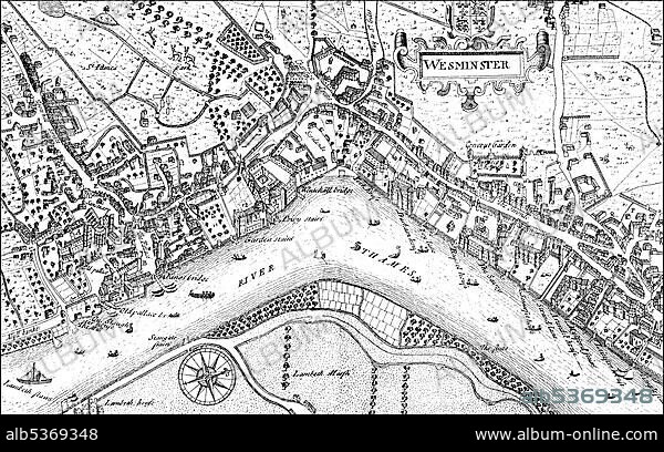
Historic drawing, city map of Westminster with the River Thames, 17th century, a district of London, England, Europe
| Partager |
|---|
 Pinterest Pinterest |
 Twitter Twitter |
 Facebook Facebook |
 Copier le lien Copier le lien |
 Email Email |
|
Ajouter à une autre Lightbox |
|
Ajouter à une autre Lightbox |


Avez-vous déjà un compte? S'identifier
Vous n'avez pas de compte ? S'inscrire
Acheter cette image.
Sélectionnez l'usage:

Légende:
Voir la traduction automatique
Historic drawing, city map of Westminster with the River Thames, 17th century, a district of London, England, Europe
Crédit:
Album / ImageBroker / H.-D. Falkenstein
Autorisations:
Taille de l'image:
5300 x 3309 px | 50.2 MB
Taille d'impression:
44.9 x 28.0 cm | 17.7 x 11.0 in (300 dpi)
Mots clés:
