alb4094581
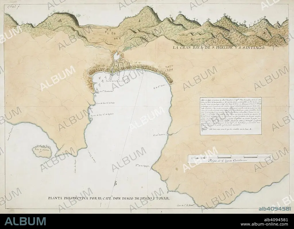
PRADO Y TOVAR, DIEGO DE, CAPTAIN. Plan of the Bay of San Phelipe and Santiago, Espiritu Santo, in the New Hebrides. Spain; circa 1606. Source: Add. 17642 F. Language: Spanish.
| Partager |
|---|
 Pinterest Pinterest |
 Twitter Twitter |
 Facebook Facebook |
 Copier le lien Copier le lien |
 Email Email |
|
Ajouter à une autre Lightbox |
|
Ajouter à une autre Lightbox |


Avez-vous déjà un compte? S'identifier
Vous n'avez pas de compte ? S'inscrire
Acheter cette image.
Sélectionnez l'usage:

Auteur: PRADO Y TOVAR, DIEGO DE, CAPTAIN
Légende: Voir la traduction automatique
Plan of the Bay of San Phelipe and Santiago, Espiritu Santo, in the New Hebrides. Spain; circa 1606. Source: Add. 17642 F. Language: Spanish.
Plan of the Bay of San Phelipe and Santiago, Espiritu Santo, in the New Hebrides. Spain; circa 1606. Source: Add. 17642 F. Language: Spanish.
Crédit: Album / British Library
Autorisations: ? Autorisation de modèle: Non - ? Autorisation de propriété: Non
Questions sur les droits?
Questions sur les droits?
Taille de l'image: 8203 × 5953 px | 139.7 MB
Taille d'impression: 69.5 × 50.4 cm | 3229.5 × 2343.7 in (300 dpi)
Mots clés: 17E SIECLE • 17EME S • BAIE • CÔTE • DIX-SEPTIÈME SIÈCLE • DOCUMENT • LITTORAL • MARITIME • OCEAN PACIFIQUE • PACIFIQUE, OCEAN • PRADO Y TOVAR, DIEGO DE, CAPTAIN • XVIIE SIECLE
