alb9235707
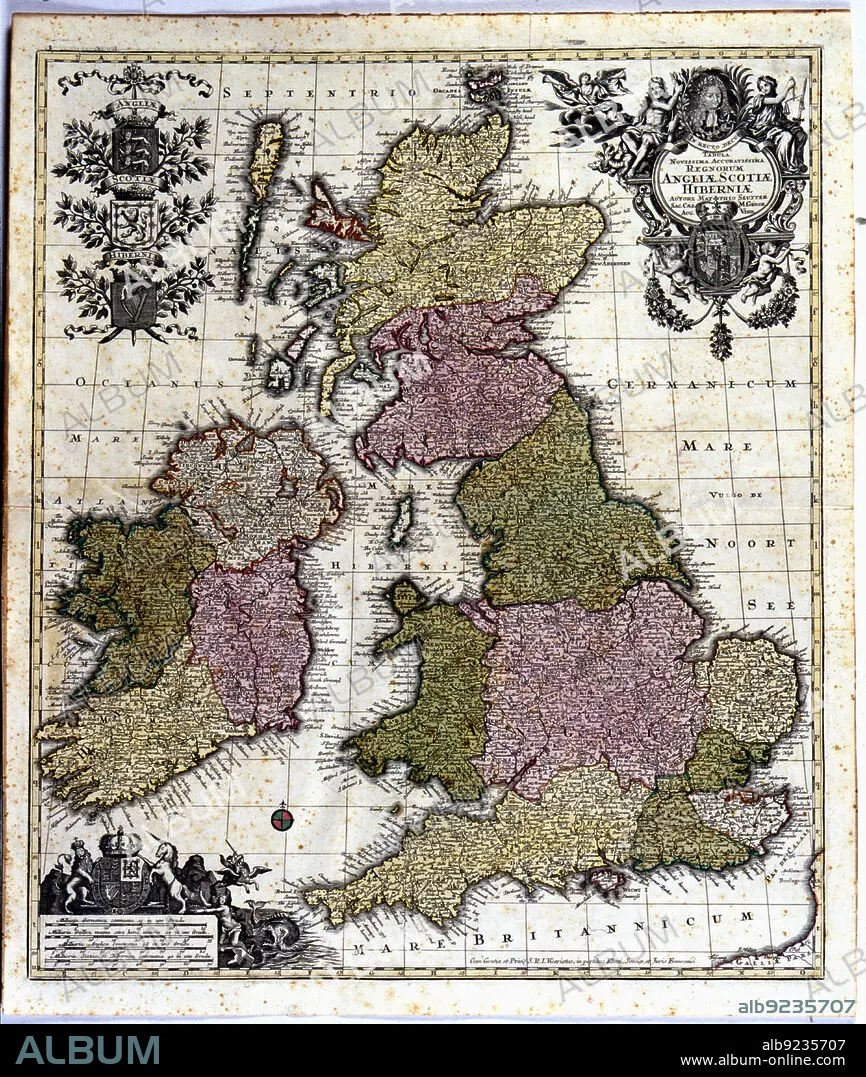
Coloured map of England, Ireland and Scotland, 1780. Creator: Seutter, Georg Matthew (1678-1757).
| Partager |
|---|
 Pinterest Pinterest |
 Twitter Twitter |
 Facebook Facebook |
 Copier le lien Copier le lien |
 Email Email |
|
Ajouter à une autre Lightbox |
|
Ajouter à une autre Lightbox |


Avez-vous déjà un compte? S'identifier
Vous n'avez pas de compte ? S'inscrire
Acheter cette image.
Sélectionnez l'usage:

Titre:
Coloured map of England, Ireland and Scotland, 1780. Creator: Seutter, Georg Matthew (1678-1757).
Légende:
Voir la traduction automatique
Coloured map of England, Ireland and Scotland. Edited in 1780.
Crédit:
Album / Arxiu Delstres - Index/Heritage Images
Autorisations:
Modèle: Non - Propriété: Non
Questions sur les droits?
Questions sur les droits?
Taille de l'image:
4797 x 5669 px | 77.8 MB
Taille d'impression:
40.6 x 48.0 cm | 16.0 x 18.9 in (300 dpi)
Mots clés:
