alb1644476
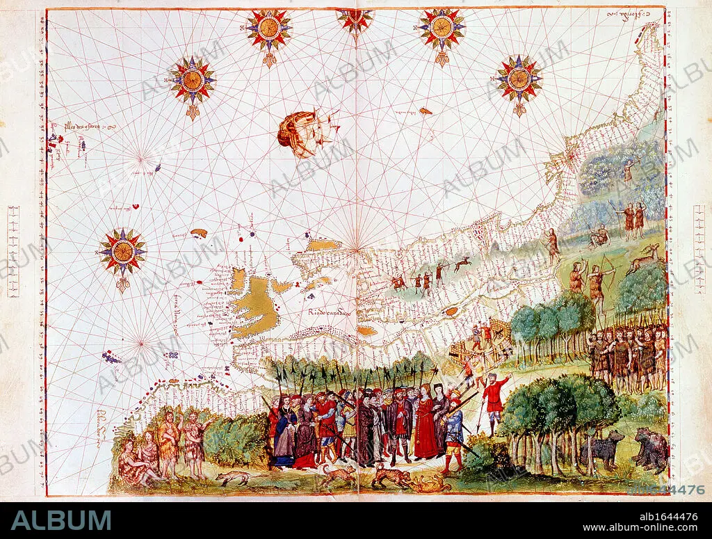
Map of east coast of North America from Labrador to Cape Florida and featuring mouth of St Lawrence. Map of pre-1547 based on Jacques Cartier's discoveries of 1534-1541.
| Partager |
|---|
 Pinterest Pinterest |
 Twitter Twitter |
 Facebook Facebook |
 Copier le lien Copier le lien |
 Email Email |
|
Ajouter à une autre Lightbox |
|
Ajouter à une autre Lightbox |


Avez-vous déjà un compte? S'identifier
Vous n'avez pas de compte ? S'inscrire
Acheter cette image

Légende:
Voir la traduction automatique
Map of east coast of North America from Labrador to Cape Florida and featuring mouth of St Lawrence. Map of pre-1547 based on Jacques Cartier's discoveries of 1534-1541
Crédit:
Album / Universal History Archive/Universal Images Group
Autorisations:
Modèle: Non - Propriété: Non
Questions sur les droits?
Questions sur les droits?
Taille de l'image:
4500 x 3174 px | 40.9 MB
Taille d'impression:
38.1 x 26.9 cm | 15.0 x 10.6 in (300 dpi)
Mots clés:
AMERIQUE • AMERIQUE, CONTINENT • BOUCHE • CARTE (GEOGRAPHIE) • CARTE GEOGRAPHIQUE • CARTE • CARTIER • CARTOGRAPHIE • CONTINENT AMERIQUE • DESSIN PLANS • EST • FLORIDE • NORD • ORIENT • PLAN (CARTOGRAPHIE) • PLANS • SCIENCE: CARTOGRAPHIE
