alb9378341
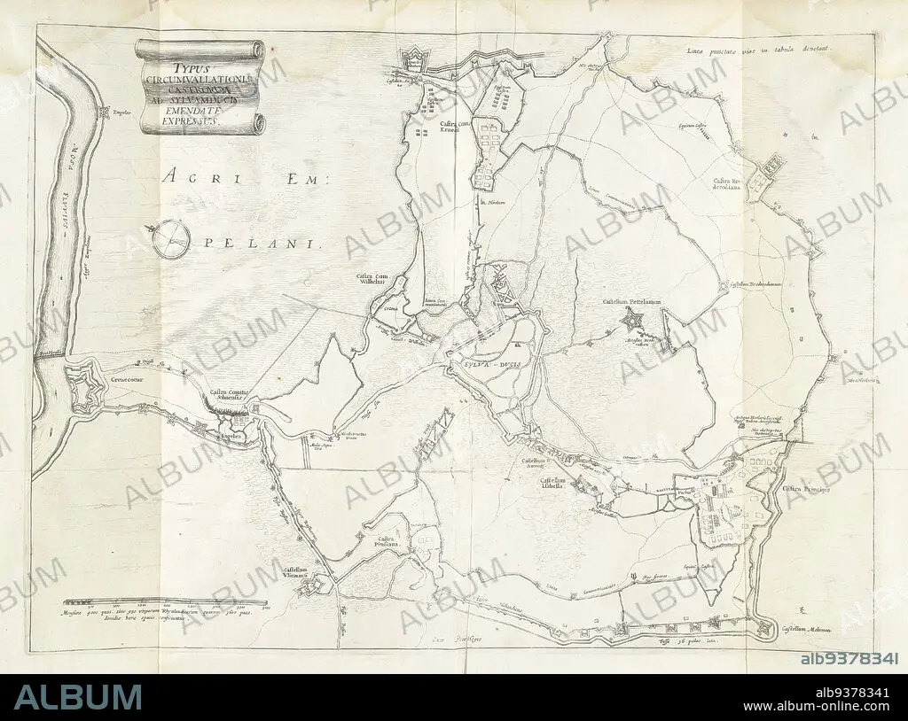
Encirclement of Den Bosch during the siege by Frederick Henry, 1629, Typus circumvallationis castrorum ad Sylvamducis, emendate expressus (title on object), Map of the encirclement of Den Bosch during the siege by the State army under Frederick Henry, from May 1 to September 17, 1629. On the left the fort Crèvecoeur on the Maas. Inscriptions in the representation in Latin., print maker: anonymous, Staten-Generaal, Northern Netherlands, 1629 - 1631, paper, etching, height 360 mm × width 493 mm.
| Partager |
|---|
 Pinterest Pinterest |
 Twitter Twitter |
 Facebook Facebook |
 Copier le lien Copier le lien |
 Email Email |
|
Ajouter à une autre Lightbox |
|
Ajouter à une autre Lightbox |


Avez-vous déjà un compte? S'identifier
Vous n'avez pas de compte ? S'inscrire
Acheter cette image.
Sélectionnez l'usage:

Légende:
Voir la traduction automatique
Encirclement of Den Bosch during the siege by Frederick Henry, 1629, Typus circumvallationis castrorum ad Sylvamducis, emendate expressus (title on object), Map of the encirclement of Den Bosch during the siege by the State army under Frederick Henry, from May 1 to September 17, 1629. On the left the fort Crèvecoeur on the Maas. Inscriptions in the representation in Latin., print maker: anonymous, Staten-Generaal, Northern Netherlands, 1629 - 1631, paper, etching, height 360 mm × width 493 mm
Crédit:
Album / quintlox
Autorisations:
Modèle: Non - Propriété: Non
Questions sur les droits?
Questions sur les droits?
Taille de l'image:
5544 x 4122 px | 65.4 MB
Taille d'impression:
46.9 x 34.9 cm | 18.5 x 13.7 in (300 dpi)
Mots clés:
