alb1962708
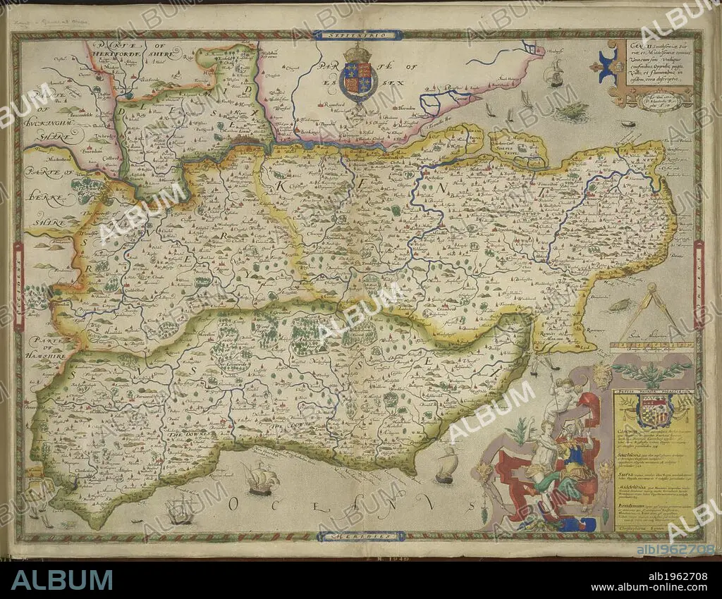
Sussex and Kent. An atlas of England and Wales, containing 35 colou. London, 1579. A map of Sussex and Kent, with parts of Essex, Buckinghamshire, Bekshire, Hampshire and Middlesex. Image taken from An atlas of England and Wales, containing 35 coloured maps, drawn by Christopher Saxton and engraved by A. Ryther, R. Hogenberg, C. Hogius, N. Reynolds, L. Terwoort and F. Scatter. Originally published/produced in 1579. Source: Maps.C.3.bb.5, f.11. Language: English.
| Partager |
|---|
 Pinterest Pinterest |
 Twitter Twitter |
 Facebook Facebook |
 Copier le lien Copier le lien |
 Email Email |
|
Ajouter à une autre Lightbox |
|
Ajouter à une autre Lightbox |


Avez-vous déjà un compte? S'identifier
Vous n'avez pas de compte ? S'inscrire
Acheter cette image.
Sélectionnez l'usage:

Légende:
Voir la traduction automatique
Sussex and Kent. An atlas of England and Wales, containing 35 colou. London, 1579. A map of Sussex and Kent, with parts of Essex, Buckinghamshire, Bekshire, Hampshire and Middlesex. Image taken from An atlas of England and Wales, containing 35 coloured maps, drawn by Christopher Saxton and engraved by A. Ryther, R. Hogenberg, C. Hogius, N. Reynolds, L. Terwoort and F. Scatter. Originally published/produced in 1579. Source: Maps.C.3.bb.5, f.11. Language: English.
Crédit:
Album / British Library
Autorisations:
Modèle: Non - Propriété: Non
Questions sur les droits?
Questions sur les droits?
Taille de l'image:
5784 x 4503 px | 74.5 MB
Taille d'impression:
49.0 x 38.1 cm | 19.3 x 15.0 in (300 dpi)
Mots clés:
