alb4088690
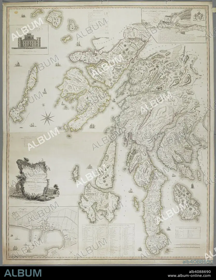
A map of Argyllshire. Map of Argyllshire, taken from actual survey, by G. Langlands and Son. Campbeltown, 1801. Source: Maps K.Top.49.25.2 TAB END. Language: English.
| Partager |
|---|
 Pinterest Pinterest |
 Twitter Twitter |
 Facebook Facebook |
 Copier le lien Copier le lien |
 Email Email |
|
Ajouter à une autre Lightbox |
|
Ajouter à une autre Lightbox |


Avez-vous déjà un compte? S'identifier
Vous n'avez pas de compte ? S'inscrire
Acheter cette image.
Sélectionnez l'usage:

Légende: Voir la traduction automatique
A map of Argyllshire. Map of Argyllshire, taken from actual survey, by G. Langlands and Son. Campbeltown, 1801. Source: Maps K.Top.49.25.2 TAB END. Language: English.
A map of Argyllshire. Map of Argyllshire, taken from actual survey, by G. Langlands and Son. Campbeltown, 1801. Source: Maps K.Top.49.25.2 TAB END. Language: English.
Crédit: Album / British Library
Autorisations: ? Autorisation de modèle: Non - ? Autorisation de propriété: Non
Questions sur les droits?
Questions sur les droits?
Taille de l'image: 6095 × 7500 px | 130.8 MB
Taille d'impression: 51.6 × 63.5 cm | 2399.6 × 2952.8 in (300 dpi)
Mots clés: ANGLETARRE • ANGLETERE • ANGLETERRE • CARTE (GEOGRAPHIE) • CARTE GEOGRAPHIQUE • CARTE • CARTOGRAPHIE • DESSIN PLANS • ECOSSE • GRANDE BERTAGNE • GRANDE BRETAGNE • GRANDE-BRETAGNE • INGLATERRA • PLAN (CARTOGRAPHIE) • PLANS • ROYAUME UNI • ROYAUME-UNI • SCIENCE: CARTOGRAPHIE • XIXE SIÈCLE
