alb5366846
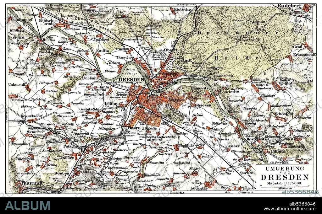
Map of Dresden and the surrounding area, Germany, Europe, end of the 19th Century, from Meyers Encyclopaedia, 1889
| Partager |
|---|
 Pinterest Pinterest |
 Twitter Twitter |
 Facebook Facebook |
 Copier le lien Copier le lien |
 Email Email |
|
Ajouter à une autre Lightbox |
|
Ajouter à une autre Lightbox |


Avez-vous déjà un compte? S'identifier
Vous n'avez pas de compte ? S'inscrire
Acheter cette image.
Sélectionnez l'usage:

Légende: Voir la traduction automatique
Map of Dresden and the surrounding area, Germany, Europe, end of the 19th Century, from Meyers Encyclopaedia, 1889, Europe
Map of Dresden and the surrounding area, Germany, Europe, end of the 19th Century, from Meyers Encyclopaedia, 1889, Europe
Crédit: Album / ImageBroker / H.-D. Falkenstein
Autorisations: ? Autorisation de modèle: Non - ? Autorisation de propriété: Non
Questions sur les droits?
Questions sur les droits?
Taille de l'image: 5345 × 3282 px | 50.2 MB
Taille d'impression: 45.3 × 27.8 cm | 2104.3 × 1292.1 in (300 dpi)
Mots clés: CADRE • CARTE ROUTIERE • CARTE • CARTES • CARTON • ILLUSTRATION • IMAGES • INTERIEUR: TABLEAUX • PEINDRE • PEINTURE, SCENES D'INTERIE • SAXE • TABLEAU: SCENES D'INTERIEU • TABLEAUX
