alb3909033
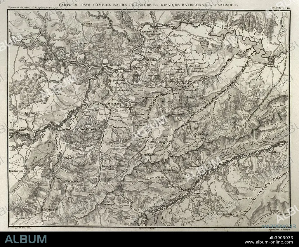
Napoleonic map. Territory between the Danube and Isar rivers, from Regensburg to Landshut (Germany). Atlas de l'Histoire du Consulat et de l'Empire. History of the Consulate and the Empire of France under Napoleon by Marie Joseph Louis Adolphe Thiers (1797-1877). Drawings by Dufour, engravings by Dyonnet. Edited in Paris, 1864.
| Partager |
|---|
 Pinterest Pinterest |
 Twitter Twitter |
 Facebook Facebook |
 Copier le lien Copier le lien |
 Email Email |
|
Ajouter à une autre Lightbox |
|
Ajouter à une autre Lightbox |


Avez-vous déjà un compte? S'identifier
Vous n'avez pas de compte ? S'inscrire
Acheter cette image.
Sélectionnez l'usage:

Légende:
Voir la traduction automatique
Napoleonic map. Territory between the Danube and Isar rivers, from Regensburg to Landshut (Germany). Atlas de l'Histoire du Consulat et de l'Empire. History of the Consulate and the Empire of France under Napoleon by Marie Joseph Louis Adolphe Thiers (1797-1877). Drawings by Dufour, engravings by Dyonnet. Edited in Paris, 1864.
Personnalités:
Crédit:
Album / Prisma
Autorisations:
Modèle: Non - Propriété: Non
Questions sur les droits?
Questions sur les droits?
Taille de l'image:
4606 x 3569 px | 47.0 MB
Taille d'impression:
39.0 x 30.2 cm | 15.4 x 11.9 in (300 dpi)
Mots clés:
ALLEMAGNE • ALLEMAND • ALLEMANDE • ANCIEN • ANTIQUE • BAVARIA • BAVIÈRE • CARTE (GEOGRAPHIE) • CARTE GEOGRAPHIQUE • CARTE • CARTOGRAPHIE • DANUBE, FLEUVE • DESSIN PLANS • DESSIN • DESSINER • EUROPE • EUROPÉEN • FANCE • FLEUVE DANUBE • FLEUVE • FLUVIALE • FRANCE • FRANÇAISE • FRAVURE • GEOGRAPHIE • GRAVURE • HISOIRE • HISTOIRE • ILLUSTRATION • ISAR • MOTIF • NAPOLÉON IER • PLAN (CARTOGRAPHIE) • PLANS • RIO • RIVIÈRE FLEUVE • RIVIERE • RIVIRE • RIVIRE • SCIENCE: CARTOGRAPHIE • TECHNIQUE: DESSIN • TERRITOIRE • THIERS • XIXE SIÈCLE
