alb9657435
map, geography, American Civil War, Richmond, Washington DC, historical,
| Partager |
|---|
 Pinterest Pinterest |
 Twitter Twitter |
 Facebook Facebook |
 Copier le lien Copier le lien |
 Email Email |
|
Ajouter à une autre Lightbox |
|
Ajouter à une autre Lightbox |


Avez-vous déjà un compte? S'identifier
Vous n'avez pas de compte ? S'inscrire
Acheter cette image.
Sélectionnez l'usage:

Titre: map, geography, American Civil War, Richmond, Washington DC, historical,
Légende: Voir la traduction automatique
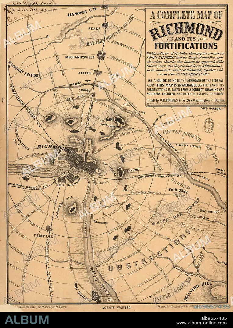
A Complete Map of Richmond and its Fortifications, American Civil War, Published by William H. Forbes & Co., 1863
A Complete Map of Richmond and its Fortifications, American Civil War, Published by William H. Forbes & Co., 1863
Crédit: Album / Universal Images Group / Circa Images
Autorisations: ? Autorisation de modèle: Non - ? Autorisation de propriété: Non
Questions sur les droits?
Questions sur les droits?
Taille de l'image: 3650 × 4891 px | 51.1 MB
Taille d'impression: 30.9 × 41.4 cm | 1437.0 × 1925.6 in (300 dpi)
Mots clés: AMERICAIN (ETATS-UNIS) • AMERICAIN (USA) • CARTE (GEOGRAPHIE) • CARTE GEOGRAPHIQUE • CARTE • CIVILE • COULEUR • DESSIN PLANS • ÉTAS UNIS • ÉTAS-UNIS • ETATS UNIS • ETATS-UNIS D'AMERIQUE (USA) • ETATS-UNIS D'AMERIQUE • ETATS-UNIS • GEOGRAPHIE • GUERRE DE SECESSION • GUERRE SECESSION • GUERRE • ILLUSTRATION • MILLESIME • PLAN (CARTOGRAPHIE) • PLANS • U. S. A. • USA • VERTICALE • XIXE SIÈCLE • ŽTATS-UNIS
