alb5407153
Joan Blaeu, Benin, Guinea, and Mauritania Map, 17th Century
| Partager |
|---|
 Pinterest Pinterest |
 Twitter Twitter |
 Facebook Facebook |
 Copier le lien Copier le lien |
 Email Email |
|
Ajouter à une autre Lightbox |
|
Ajouter à une autre Lightbox |


Avez-vous déjà un compte? S'identifier
Vous n'avez pas de compte ? S'inscrire
Acheter cette image.
Sélectionnez l'usage:

Titre:
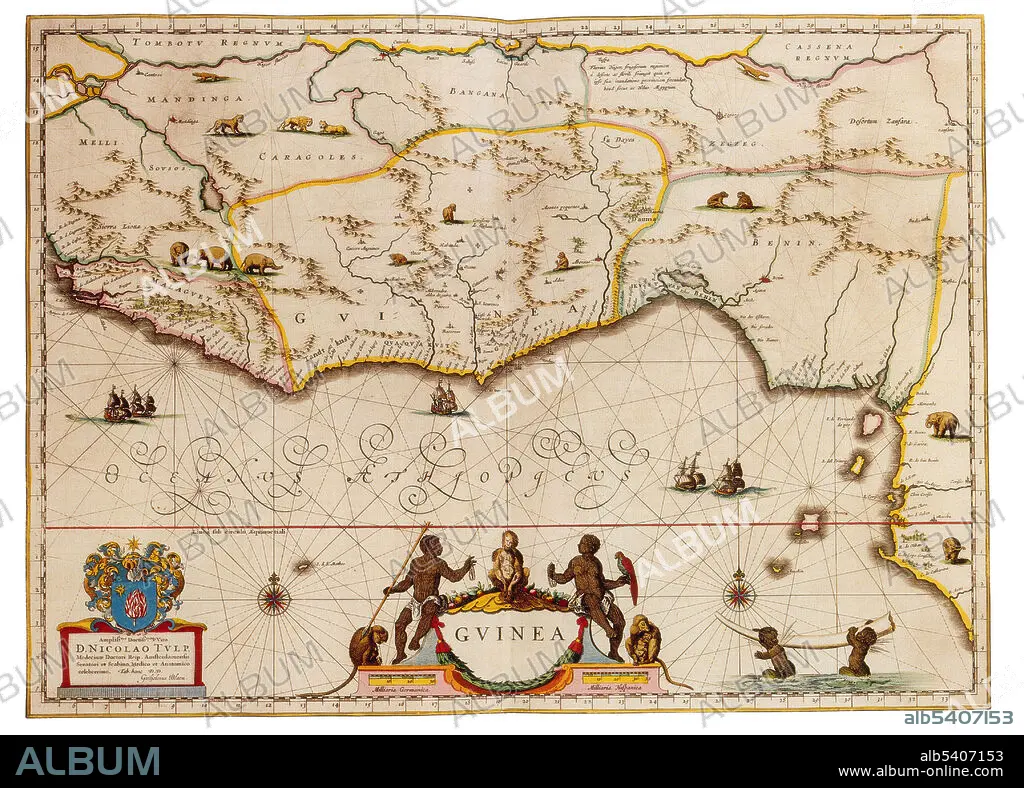
Joan Blaeu, Benin, Guinea, and Mauritania Map, 17th Century
Légende:
Voir la traduction automatique
The countries of Benin, Guinea, and Mauritania. West Africa is the westernmost region of Africa. West Africa has been defined as including 17 countries: Benin, Burkina Faso, the island nation of Cape Verde, Gambia, Ghana, Guinea, Guinea-Bissau, Ivory Coast, Liberia, Mali, Mauritania, Niger, Nigeria, the islands of Saint Helena, Ascension and Tristan da Cunha, Senegal, Sierra Leone and Togo. Joan Blaeu (1596-1673) was a Dutch cartographer, the son of cartographer Willem Blaeu. In 1635 they published the Atlas Novus (full title: Theatrum orbis terrarum, sive, Atlas novus) in two volumes. The Atlas Maior is the final version of Joan Blaeu's atlas, published in Amsterdam between 1662 and 1672, in Latin, French, Dutch, German and Spanish, containing 594 maps and around 3,000 pages of text. The Blaeu maps emphasized fine art and colours, being the most expensive of the time.
Personnalités:
Crédit:
Album / Science Source
Autorisations:
Taille de l'image:
4350 x 3124 px | 38.9 MB
Taille d'impression:
36.8 x 26.4 cm | 14.5 x 10.4 in (300 dpi)
Mots clés:
17E SIECLE • 17EME S • AFRIQUE • BÉNIN • CARTE • CARTOGRAPHIE • CÉLÈBRE • CELEBRITE • DIX-SEPTIÈME SIÈCLE • GEOGRAPHIE • GUINEE • OCCIDENTAL • OCCIDENTAUX • OUEST • RÉPUBLIQUE DE GUINÉE • SCIENCE: CARTOGRAPHIE • WESTERN • XVIIE SIECLE
