alb3982105
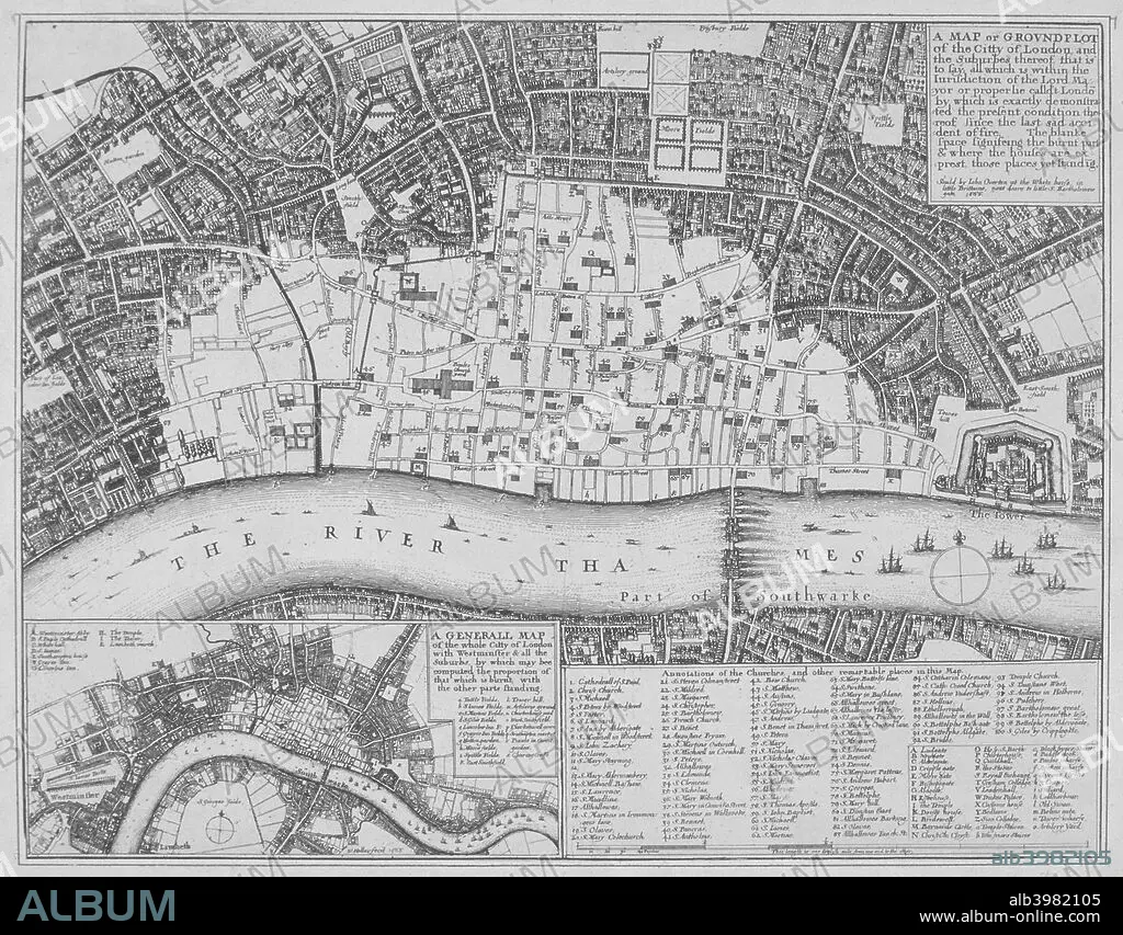
Map showing the extent of the damage caused by the Great Fire of London, 1666. Artist: Wenceslaus Hollar
| Partager |
|---|
 Pinterest Pinterest |
 Twitter Twitter |
 Facebook Facebook |
 Copier le lien Copier le lien |
 Email Email |
|
Ajouter à une autre Lightbox |
|
Ajouter à une autre Lightbox |


Avez-vous déjà un compte? S'identifier
Vous n'avez pas de compte ? S'inscrire
Acheter cette image.
Sélectionnez l'usage:

Titre:
Map showing the extent of the damage caused by the Great Fire of London, 1666. Artist: Wenceslaus Hollar
Légende:
Voir la traduction automatique
Map showing the extent of the damage caused by the Great Fire of London, 1666.
Personnalités:
Crédit:
Album / The London Archives (City of London)/Heritage Images
Autorisations:
Modèle: Non - Propriété: Non
Questions sur les droits?
Questions sur les droits?
Taille de l'image:
2834 x 2215 px | 18.0 MB
Taille d'impression:
24.0 x 18.8 cm | 9.4 x 7.4 in (300 dpi)
Mots clés:
ANGLETERRE • CARTE • CARTOGRAPHIE • DEGAT • DESTRCUTION • DESTRUCTION • DESTRUCUTION • DETERIORATION • DEVASTATION • ENDOMMAGEMENT • ÉVÉNEMENT • FLEUVE TAMISE • GEOGRAPHIE • HOLLAR • SCIENCE: CARTOGRAPHIE • TAMISE • TAMISE, FLEUVE • WENCESLAUS HOLLAR
