alb9635617
JOHN DOWER. Plan of Constantinople and its Suburbs, 1856. Creator: John Dower.
| Partager |
|---|
 Pinterest Pinterest |
 Twitter Twitter |
 Facebook Facebook |
 Copier le lien Copier le lien |
 Email Email |
|
Ajouter à une autre Lightbox |
|
Ajouter à une autre Lightbox |


Avez-vous déjà un compte? S'identifier
Vous n'avez pas de compte ? S'inscrire
Acheter cette image.
Sélectionnez l'usage:

Auteur:
Titre:
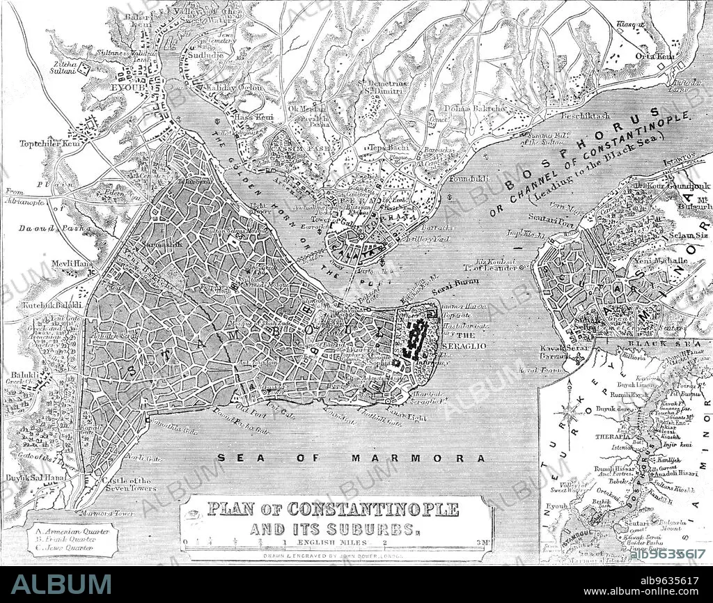
Plan of Constantinople and its Suburbs, 1856. Creator: John Dower.
Légende:
Voir la traduction automatique
Plan of Constantinople and its Suburbs, 1856. Map showing the city of Constantinople (modern Istanbul, Turkey), including the 'Golden Horn or the Port'; the Bosphorus 'or Channel of Constantinople, leading to the Black Sea'; the Sea of Marmora, the 'Armenian, Frank and Jews' Quarters, pontoon bridge and the Seraglio. From "Illustrated London News", 1856.
Crédit:
Album /Heritage Images
Autorisations:
Taille de l'image:
3607 x 2863 px | 29.5 MB
Taille d'impression:
30.5 x 24.2 cm | 12.0 x 9.5 in (300 dpi)
Mots clés:
CÔTE • COULEUR • DOWER, JOHN • GEOGRAPHIE • ISTANBUL • JOURNAL • LITTORAL • MARITIME • NOIR ET BLANC • XIXE SIÈCLE
